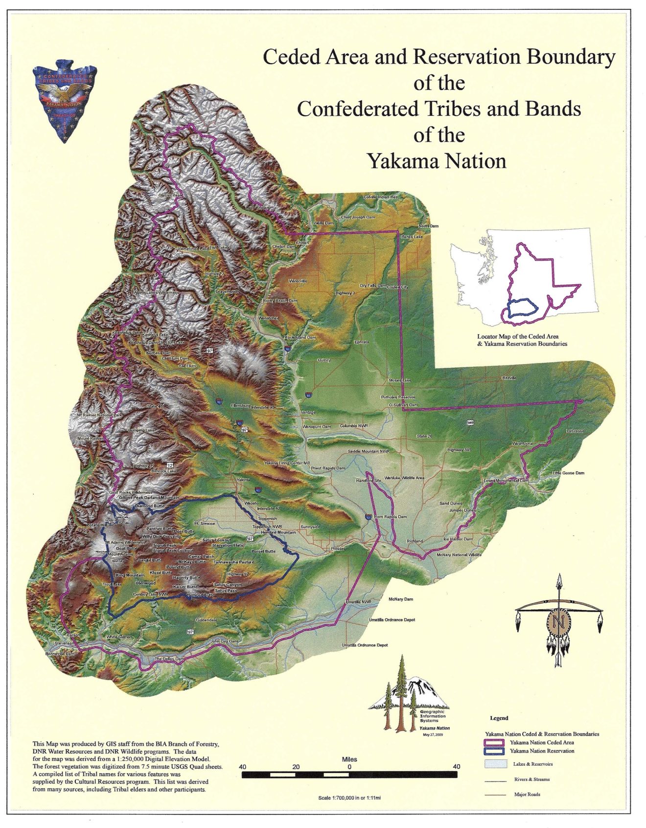
Yakama Nation Geographic Information Systems (GIS) Program
The Yakama Nation's Geographic Information Systems (GIS) program plays a crucial role in managing and protecting the tribe's valuable resources. By leveraging advanced spatial data and technology, the program empowers tribal resource specialists to develop effective management strategies and safeguard the rights of the Yakama Nation, as established by the Treaty of June 9, 1855.
This initiative provides essential geographic and parcel information that underpins informed decision-making for resource management, land use planning, and the protection of treaty-guaranteed rights. The program's work is foundational to maintaining the ecological health and economic well-being of the Yakama Nation.
Mission and Objectives of the Yakama Nation GIS Program
The primary mission of the Yakama Nation's GIS program is to provide accurate, reliable, and accessible geographic information to support the tribe's resource management efforts and uphold treaty rights. This involves collecting, analyzing, and disseminating spatial data critical for environmental stewardship and tribal sovereignty.
Key objectives include developing and maintaining comprehensive GIS databases, offering technical expertise to tribal departments, and ensuring that spatial information is used to inform policy and operational decisions. The program aims to foster a deeper understanding of the Yakama Nation's lands and resources through the power of geographic analysis.
Contacting the Yakama Nation GIS Department
For inquiries regarding geographic information, resource management data, or services provided by the Yakama Nation's Geographic Information Systems program, direct contact is available. The program serves as a central point for accessing vital spatial data and technical assistance related to tribal lands and resources.
You can reach the GIS department by phone at (509) 865-5121, extension [Please specify extension if available]. This contact information ensures that tribal members, resource specialists, and other stakeholders can easily connect with the program for their specific needs and to obtain the necessary geographic information.
Supporting Tribal Resource Management and Rights Protection
The Geographic Information Systems program is instrumental in equipping the Yakama Nation's resource specialists with the tools and data needed to implement innovative management solutions. This includes detailed mapping, land use analysis, and environmental monitoring, all contributing to the sustainable use of tribal lands.
By providing precise geographic data, the GIS program directly supports the protection of rights guaranteed to the Yakama Nation under the Treaty of June 9, 1855. This includes ensuring that land use decisions and resource allocations are consistent with treaty obligations and tribal interests.